Geolocate

Corniga topographic map

Click on the map to display elevation.

About this map

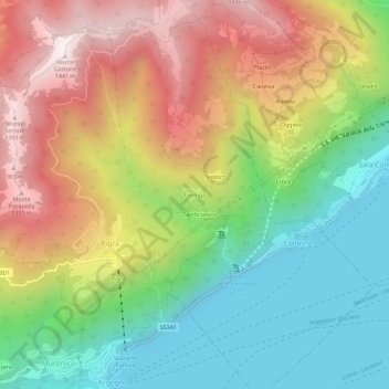
Name: Corniga topographic map, elevation, terrain.

Location: Corniga, Colonno, Como, Lombardy, 22010, Italy (45.94255 9.12026 45.98255 9.16026)

Average elevation: 726 m

Minimum elevation: 183 m

Maximum elevation: 1,428 m

Gear up for your next adventure:

🛌Insulated Sleeping Pad - Critical thermal barrier between you and the cold ground
🦌Outdoor Trail Camera - Monitor wildlife activity near your favorite spots
🌡️Emergency Mylar Blankets - Compact thermal protection for unexpected nights outdoors
🧥Waterproof Jacket - Lightweight rain jackets for hiking and outdoor activities
🎒Backpack Rain Cover - External shield to keep your entire pack dry

As an Amazon Associate, this site earns from qualifying purchases at no extra cost to you.