Geolocate

北流村 topographic map

Click on the map to display elevation.

About this map

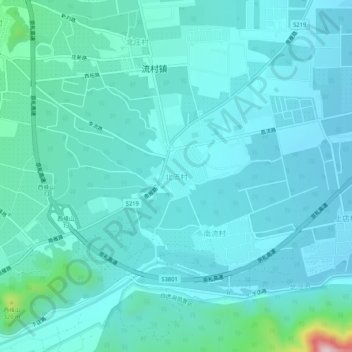
Name: 北流村 topographic map, elevation, terrain.

Location: 北流村, Changping District, Beijing, China (40.14876 116.04064 40.18876 116.08064)

Average elevation: 144 m

Minimum elevation: 97 m

Maximum elevation: 482 m

Gear up for your next adventure:

🥾Trail Running Boots - Durable shoes designed for trail running
🥾Approach Boots - Comfortable boots for hiking and climbing approaches
🦯Trekking Poles - Reduced impact on joints for steep topographic climbs
🎒Hiking Daypack - Lightweight and durable backpacks for day trips and excursions
🧢Outdoor Visor - Breathable visor for sunny hikes

As an Amazon Associate, this site earns from qualifying purchases at no extra cost to you.