
Thank you for supporting this site ❤️
Make a donation
Make a donation
Gear up for your next adventure:
As an Amazon Associate, this site earns from qualifying purchases at no extra cost to you.
Thifelfel topographic map
Click on the map to display elevation.
Thank you for supporting this site ❤️
Make a donation
Make a donation
Gear up for your next adventure:
As an Amazon Associate, this site earns from qualifying purchases at no extra cost to you.
About this map
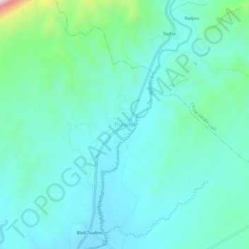
Name: Thifelfel topographic map, elevation, terrain.
Location: Thifelfel, Ghassira, Daïra de T'Kout, Batna, 50002, Algérie (35.09817 6.21371 35.13817 6.25371)
Average elevation: 856 m
Minimum elevation: 748 m
Maximum elevation: 1,373 m
Thank you for supporting this site ❤️
Make a donation
Make a donation
Gear up for your next adventure:
As an Amazon Associate, this site earns from qualifying purchases at no extra cost to you.