
Camagüey topographic map
Interactive map
Click on the map to display elevation.
About this map
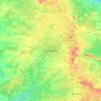
Name: Camagüey topographic map, elevation, terrain.
Location: Camagüey, 70 100, Cuba (21.21918 -78.07837 21.53918 -77.75837)
Average elevation: 100 m
Minimum elevation: 50 m
Maximum elevation: 188 m
Other topographic maps
Click on a map to view its topography, its elevation and its terrain.