Geolocate

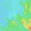
Lac Chalain topographic map

Click on the map to display elevation.

About this map

Name: Lac Chalain topographic map, elevation, terrain.

Location: Lac Chalain, Lac-Pythonga, La Vallée-de-la-Gatineau, Outaouais, Québec, Canada (47.20575 -76.74291 47.21495 -76.73828)

Average elevation: 384 m

Minimum elevation: 353 m

Maximum elevation: 449 m

Other topographic maps

Click on a map to view its topography, its elevation and its terrain.

Gear up for your next adventure:

🧢Hiking Hat - Sun-protective and breathable hats for long treks
🔭Compact Binoculars - Lightweight optics for scouting trails and wildlife
🦯Trekking Poles - Reduced impact on joints for steep topographic climbs
👟Trail Running Shoes - Agile footwear for fast-paced topographic exploration
⛺Bushcraft Tarp - Versatile emergency shelter or gear protection

As an Amazon Associate, this site earns from qualifying purchases at no extra cost to you.