
Thank you for supporting this site ❤️
Make a donation
Make a donation
Gear up for your next adventure:
As an Amazon Associate, this site earns from qualifying purchases at no extra cost to you.
Wechelderzande topographic map
Click on the map to display elevation.
Thank you for supporting this site ❤️
Make a donation
Make a donation
Gear up for your next adventure:
As an Amazon Associate, this site earns from qualifying purchases at no extra cost to you.
About this map
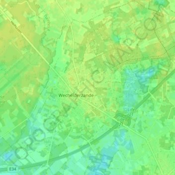
Name: Wechelderzande topographic map, elevation, terrain.
Location: Wechelderzande, Lille, Turnhout, Antwerpen, Vlaanderen, België (51.24253 4.76131 51.28824 4.82042)
Average elevation: 17 m
Minimum elevation: 8 m
Maximum elevation: 23 m
Thank you for supporting this site ❤️
Make a donation
Make a donation
Gear up for your next adventure:
As an Amazon Associate, this site earns from qualifying purchases at no extra cost to you.