
Thank you for supporting this site ❤️
Make a donation
Make a donation
Gear up for your next adventure:
As an Amazon Associate, this site earns from qualifying purchases at no extra cost to you.
Hereford topographic map
Click on the map to display elevation.
Thank you for supporting this site ❤️
Make a donation
Make a donation
Gear up for your next adventure:
As an Amazon Associate, this site earns from qualifying purchases at no extra cost to you.
About this map
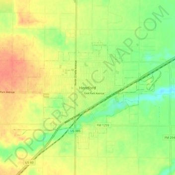
Name: Hereford topographic map, elevation, terrain.
Location: Hereford, Deaf Smith County, Texas, 79045, United States (34.78455 -102.43878 34.86455 -102.35878)
Average elevation: 1,168 m
Minimum elevation: 1,143 m
Maximum elevation: 1,190 m
Thank you for supporting this site ❤️
Make a donation
Make a donation
Gear up for your next adventure:
As an Amazon Associate, this site earns from qualifying purchases at no extra cost to you.