Geolocate

Foraquira topographic map

Click on the map to display elevation.

About this map

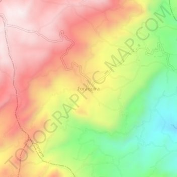
Name: Foraquira topographic map, elevation, terrain.

Location: Foraquira, Jenesano, Márquez, Boyacá, 153601, Colombia (5.36945 -73.42304 5.40945 -73.38304)

Average elevation: 2,619 m

Minimum elevation: 2,202 m

Maximum elevation: 2,966 m

Gear up for your next adventure:

🔦LED Headtorch - Bright and durable light for night activities
🦶Anti-Blister Balm - Prevents friction and hotspots during long ascents
🗺️Topographic Maps - Detailed maps to explore trails, mountains, and wilderness areas
🔋Lithium AA Batteries - Long-lasting power that performs in extreme cold
🧭GPS Tracker - Track your location in remote areas safely

As an Amazon Associate, this site earns from qualifying purchases at no extra cost to you.