
Thank you for supporting this site ❤️
Make a donation
Make a donation
Gear up for your next adventure:
As an Amazon Associate, this site earns from qualifying purchases at no extra cost to you.
Matmata topographic map
Click on the map to display elevation.
Thank you for supporting this site ❤️
Make a donation
Make a donation
Gear up for your next adventure:
As an Amazon Associate, this site earns from qualifying purchases at no extra cost to you.
About this map
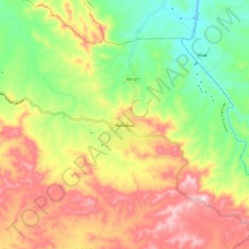
Name: Matmata topographic map, elevation, terrain.
Location: Matmata, مطماطة, معتمدية مطماطة, Gabès, 6070, Tunisia (33.50573 9.92734 33.58573 10.00734)
Average elevation: 364 m
Minimum elevation: 203 m
Maximum elevation: 541 m
Thank you for supporting this site ❤️
Make a donation
Make a donation
Gear up for your next adventure:
As an Amazon Associate, this site earns from qualifying purchases at no extra cost to you.