
Thank you for supporting this site ❤️
Make a donation
Make a donation
Gear up for your next adventure:
As an Amazon Associate, this site earns from qualifying purchases at no extra cost to you.
Guápiles topographic map
Click on the map to display elevation.
Thank you for supporting this site ❤️
Make a donation
Make a donation
Gear up for your next adventure:
As an Amazon Associate, this site earns from qualifying purchases at no extra cost to you.
About this map
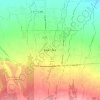
Name: Guápiles topographic map, elevation, terrain.
Location: Guápiles, Cantón Pococí, Provincia Limón, 70201, Costa Rica (10.17544 -83.83136 10.25544 -83.75136)
Average elevation: 257 m
Minimum elevation: 125 m
Maximum elevation: 437 m
Thank you for supporting this site ❤️
Make a donation
Make a donation
Gear up for your next adventure:
As an Amazon Associate, this site earns from qualifying purchases at no extra cost to you.