
Thank you for supporting this site ❤️
Make a donation
Make a donation
Gear up for your next adventure:
As an Amazon Associate, this site earns from qualifying purchases at no extra cost to you.
Marlishausen topographic map
Click on the map to display elevation.
Thank you for supporting this site ❤️
Make a donation
Make a donation
Gear up for your next adventure:
As an Amazon Associate, this site earns from qualifying purchases at no extra cost to you.
About this map
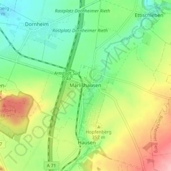
Name: Marlishausen topographic map, elevation, terrain.
Location: Marlishausen, Arnstadt, Ilm-Kreis, Thüringen, Deutschland (50.80128 10.99343 50.84197 11.04578)
Average elevation: 332 m
Minimum elevation: 279 m
Maximum elevation: 417 m
Thank you for supporting this site ❤️
Make a donation
Make a donation
Gear up for your next adventure:
As an Amazon Associate, this site earns from qualifying purchases at no extra cost to you.