
Kundus topographic map
Interactive map
Click on the map to display elevation.
About this map
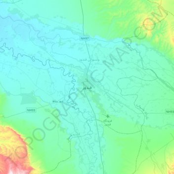
Name: Kundus topographic map, elevation, terrain.
Location: Kundus, Bezirk Kunduz, Provinz Kundus, Afghanistan (36.55756 68.70729 36.87756 69.02729)
Average elevation: 453 m
Minimum elevation: 356 m
Maximum elevation: 1,127 m
Kundus (paschto/persisch کندوز Kunduz, DMG Kundūz, auch قندوز Qundūz, ursprünglich Qhunduz) ist die Hauptstadt der gleichnamigen Provinz Kundus. Sie befindet sich im Nordosten von Afghanistan im Tal des Zuflusses Kundus zum Amudarja nahe der tadschikischen Grenze, rund 250 km nördlich von Kabul. In der Stadt leben im Jahr 2019 etwa 350.000 Einwohner. Kundus liegt auf einer Höhe von 397 m.