Geolocate

San Rafael topographic map

Click on the map to display elevation.

About this map

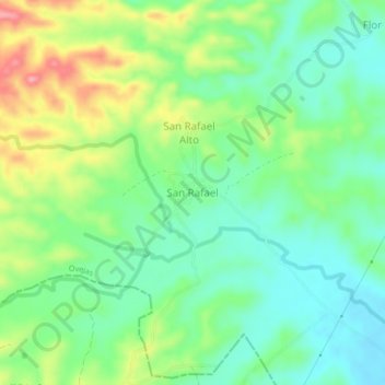
Name: San Rafael topographic map, elevation, terrain.

Location: San Rafael, Ovejas, Montes de María, Sucre, Colombia (9.46417 -75.19134 9.50417 -75.15134)

Average elevation: 195 m

Minimum elevation: 155 m

Maximum elevation: 270 m

Gear up for your next adventure:

🕯️Camping Lantern - Illuminates your entire campsite with high-efficiency LEDs
🦟Insect Repellent - Keep mosquitoes and black flies away in wooded areas
🦯Trekking Poles - Reduced impact on joints for steep topographic climbs
🐕Hiking Dog Pack - Let your canine companion carry their own water and food
🧰Emergency Multi-Tool - Compact multi-tool for outdoor survival

As an Amazon Associate, this site earns from qualifying purchases at no extra cost to you.