Geolocate

Sagneset topographic map

Click on the map to display elevation.

About this map

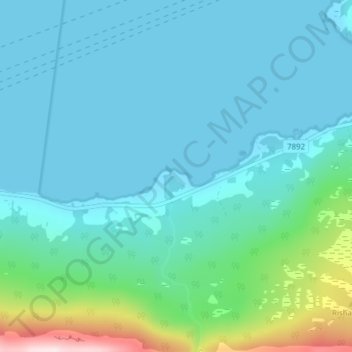
Name: Sagneset topographic map, elevation, terrain.

Location: Sagneset, Elvevoll, Tromsø, Troms og Finnmark, Norway (69.53589 18.66607 69.53599 18.66617)

Average elevation: 60 m

Minimum elevation: 0 m

Maximum elevation: 399 m

Other topographic maps

Click on a map to view its topography, its elevation and its terrain.

Gear up for your next adventure:

🥾Trekking Poles - Adjustable trekking poles to reduce knee stress and improve stability
🌡️Emergency Mylar Blankets - Compact thermal protection for unexpected nights outdoors
🧤Thermal Hiking Gloves - Grip-enhanced gloves for cold-weather altitude trekking
Lightweight Backpacking Tent - Compact tent for efficient hiking trips
🚲Bike Repair Kit - Essential tools for on-trail mechanical issues

As an Amazon Associate, this site earns from qualifying purchases at no extra cost to you.