
Hougarou topographic map
Interactive map
Click on the map to display elevation.
About this map
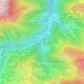
Name: Hougarou topographic map, elevation, terrain.
Average elevation: 951 m
Minimum elevation: 490 m
Maximum elevation: 1,701 m
Other topographic maps
Click on a map to view its topography, its elevation and its terrain.
Col du Soulor
France > Occitanie > Hautes-Pyrénées > Arbéost
Col du Soulor, Arbéost, Argelès-Gazost, Hautes-Pyrénées, Occitanie, France métropolitaine, 65560, France
Average elevation: 1,469 m
Les Bourinquets
France > Occitanie > Hautes-Pyrénées > Arbéost > Les Bourinquets
Les Bourinquets, Arbéost, Argelès-Gazost, Hautes-Pyrénées, Occitanie, France métropolitaine, 65560, France
Average elevation: 1,027 m