Geolocate

Pucara topographic map

Click on the map to display elevation.

About this map

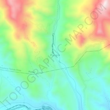
Name: Pucara topographic map, elevation, terrain.

Location: Pucara, Potosí, Provincia Tomás Frías, Potosí, Bolivia (-19.50083 -65.61669 -19.46083 -65.57669)

Average elevation: 3,763 m

Minimum elevation: 3,527 m

Maximum elevation: 4,211 m

Gear up for your next adventure:

🧤Insulated Winter Gloves - Heavy-duty protection for sub-zero Canadian adventures
🎒Fully Waterproof Backpack - Total protection for photography gear and electronics
🕶️Polarized Sunglasses - Reduces glare from snow and water at high elevations
🎒Hiking Backpack - Lightweight and ergonomic backpacks for day hikes or multi-day treks
🔋Lithium AA Batteries - Long-lasting power that performs in extreme cold

As an Amazon Associate, this site earns from qualifying purchases at no extra cost to you.