Geolocate

Pucapampa topographic map

Click on the map to display elevation.

About this map

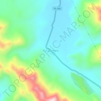
Name: Pucapampa topographic map, elevation, terrain.

Location: Pucapampa, Santa Ana, Castrovirreyna, Huancavelica, Perú (-13.05393 -75.11146 -13.01393 -75.07146)

Average elevation: 4,702 m

Minimum elevation: 4,552 m

Maximum elevation: 5,120 m

Gear up for your next adventure:

🌡️Emergency Mylar Blankets - Compact thermal protection for unexpected nights outdoors
🧭Orienteering Kit - Tools for map reading and navigation in the wild
🥾Mountaineering Boots - Supportive boots for climbing and high-altitude hiking
🥾Trekking Poles - Adjustable trekking poles to reduce knee stress and improve stability
🧦Hiking Socks - Moisture-wicking and comfortable socks for long hikes

As an Amazon Associate, this site earns from qualifying purchases at no extra cost to you.