Geolocate

Binsar topographic map

Click on the map to display elevation.

About this map

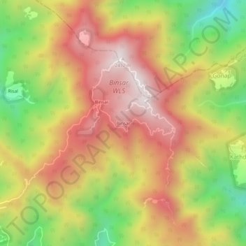
Name: Binsar topographic map, elevation, terrain.

Location: Binsar, Almora, Uttarakhand, 263600, India (29.67670 79.73381 29.71670 79.77381)

Average elevation: 1,954 m

Minimum elevation: 1,433 m

Maximum elevation: 2,384 m

Gear up for your next adventure:

💡LED Camping Lantern - Illuminate your campsite with long-lasting lanterns
🧥Fleece Jacket - Warm and lightweight jacket for layering
🧥Ultralight Puffy Jacket - Maximum warmth that packs down to the size of an orange
Lightweight Camping Tent - Portable shelter optimized for Canadian backcountry camping
🦯Trekking Poles - Reduced impact on joints for steep topographic climbs

As an Amazon Associate, this site earns from qualifying purchases at no extra cost to you.