
Bad Fallingbostel topographic map
Interactive map
Click on the map to display elevation.
About this map
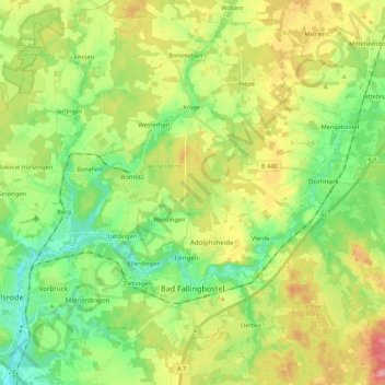
Name: Bad Fallingbostel topographic map, elevation, terrain.
Location: Bad Fallingbostel, Heidekreis, Nedersaksen, 29683, Duitsland (52.83850 9.64492 52.95730 9.86096)
Average elevation: 64 m
Minimum elevation: 27 m
Maximum elevation: 120 m
Other topographic maps
Click on a map to view its topography, its elevation and its terrain.
Wilseder Berg
Duitsland > Nedersaksen > Heidekreis > Niederhaverbeck
Wilseder Berg, Niederhaverbeck, Heidetal, Niederhaverbeck, Bispingen, Heidekreis, Nedersaksen, 29646, Duitsland
Average elevation: 125 m
Schneverdingen
Duitsland > Nedersaksen > Heidekreis
Schneverdingen, Heidekreis, Nedersaksen, 29640, Duitsland
Average elevation: 72 m