Geolocate

Montisoni topographic map

Click on the map to display elevation.

About this map

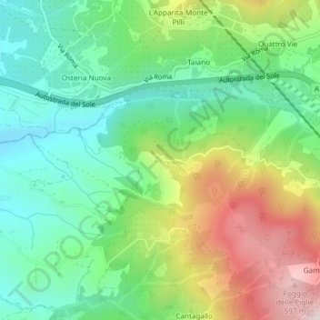
Name: Montisoni topographic map, elevation, terrain.

Location: Montisoni, Bagno a Ripoli, Florence, Tuscany, 50012, Italy (43.71279 11.34457 43.73279 11.36457)

Average elevation: 310 m

Minimum elevation: 137 m

Maximum elevation: 619 m

Gear up for your next adventure:

🥾Hiking Shorts - Breathable shorts suitable for summer hikes
🥾Waterproof Hiking Shoes - Durable shoes for wet and rugged trails
🔦LED Headtorch - Bright and durable light for night activities
🧥Softshell Hiking Jacket - The perfect balance of wind protection and breathability
🚲MTB Frame Bag - Carry tools and maps directly on your bicycle frame

As an Amazon Associate, this site earns from qualifying purchases at no extra cost to you.