
Thank you for supporting this site ❤️
Make a donation
Make a donation
Gear up for your next adventure:
As an Amazon Associate, this site earns from qualifying purchases at no extra cost to you.
Fojo topographic map
Click on the map to display elevation.
Thank you for supporting this site ❤️
Make a donation
Make a donation
Gear up for your next adventure:
As an Amazon Associate, this site earns from qualifying purchases at no extra cost to you.
About this map
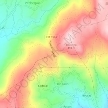
Name: Fojo topographic map, elevation, terrain.
Location: Fojo, Dossãos, Vila Verde, Braga, 4730-360, Portugal (41.67762 -8.48105 41.69762 -8.46105)
Average elevation: 336 m
Minimum elevation: 185 m
Maximum elevation: 489 m
Thank you for supporting this site ❤️
Make a donation
Make a donation
Gear up for your next adventure:
As an Amazon Associate, this site earns from qualifying purchases at no extra cost to you.