Geolocate

Laoting County topographic map

Click on the map to display elevation.

About this map

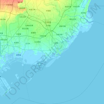
Name: Laoting County topographic map, elevation, terrain.

Location: Laoting County, Tangshan City, Hebei, China (38.86747 118.68076 39.57369 119.54704)

Average elevation: 3 m

Minimum elevation: -4 m

Maximum elevation: 30 m

Gear up for your next adventure:

Camping Coffee Maker - Brew fresh coffee anywhere on the topographic map
🔦LED Headlamp - Hands-free lighting for early morning starts or late finishes
💧Reusable Water Bottle - Durable water bottles for hydration on trails
🔪Outdoor Multitool - Versatile tool for repairs and food prep in the wild
❄️Traction Ice Cleats - Slip-on spikes for icy trails and winter hiking

As an Amazon Associate, this site earns from qualifying purchases at no extra cost to you.