Geolocate

Markanda topographic map

Click on the map to display elevation.

About this map

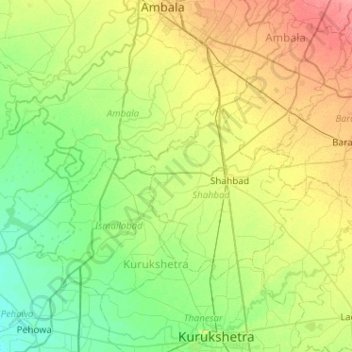
Name: Markanda topographic map, elevation, terrain.

Location: Markanda, Shahbad, Kurukshetra, Haryana, 136130, India (30.06508 76.51687 30.27850 77.02908)

Average elevation: 263 m

Minimum elevation: 243 m

Maximum elevation: 300 m

Gear up for your next adventure:

🧦Merino Wool Socks - Moisture-wicking comfort for long-distance hiking
🛏️Camping Sleeping Mat - Comfortable mats for sleeping outdoors
🔋Solar Power Bank - Keep your GPS and devices charged during long outdoor trips
🧢Hiking Sun Hat - Wide-brimmed protection for exposed mountain ridges
🧥Waterproof Pants - Keep dry during rainy hiking conditions

As an Amazon Associate, this site earns from qualifying purchases at no extra cost to you.