Geolocate

Kotdwar topographic map

Click on the map to display elevation.

Kotdwar

Kotdwar lies on the western margin of the Himalayas, at an altitude of 454 m (1,490 ft) above sea level.

Wikipedia (CC-BY-SA 3.0)

About this map

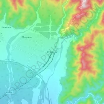
Name: Kotdwar topographic map, elevation, terrain.

Location: Kotdwar, Kotdwara, Pauri Garhwal District, Uttarakhand, 246149, India (29.70598 78.48014 29.78598 78.56014)

Average elevation: 471 m

Minimum elevation: 324 m

Maximum elevation: 910 m

Gear up for your next adventure:

🛰️Satellite Messenger - Emergency communication for areas with no cell service
Lightweight Backpacking Tent - Compact tent for efficient hiking trips
🧴Outdoor Sunscreen - High SPF protection for high-altitude UV exposure
🕶️Polarized Sunglasses - Reduces glare from snow and water at high elevations
🔦LED Headtorch - Bright and durable light for night activities

As an Amazon Associate, this site earns from qualifying purchases at no extra cost to you.