
Thank you for supporting this site ❤️
Make a donation
Make a donation
Gear up for your next adventure:
As an Amazon Associate, this site earns from qualifying purchases at no extra cost to you.
Kombai topographic map
Click on the map to display elevation.
Thank you for supporting this site ❤️
Make a donation
Make a donation
Gear up for your next adventure:
As an Amazon Associate, this site earns from qualifying purchases at no extra cost to you.
About this map
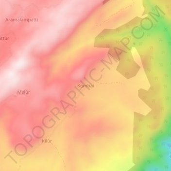
Name: Kombai topographic map, elevation, terrain.
Location: Kombai, Tirupathur, Tirupattur District, Tamil Nadu, India (12.36165 78.68565 12.40165 78.72565)
Average elevation: 883 m
Minimum elevation: 488 m
Maximum elevation: 1,060 m
Thank you for supporting this site ❤️
Make a donation
Make a donation
Gear up for your next adventure:
As an Amazon Associate, this site earns from qualifying purchases at no extra cost to you.