Geolocate

Dewal topographic map

Click on the map to display elevation.

About this map

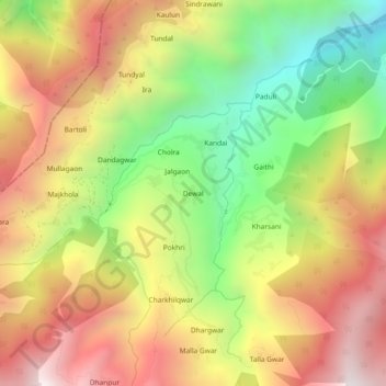
Name: Dewal topographic map, elevation, terrain.

Location: Dewal, Karnaprayag, Chamoli, Uttarakhand, India (30.22168 79.09521 30.26168 79.13521)

Average elevation: 1,839 m

Minimum elevation: 1,117 m

Maximum elevation: 2,534 m

Other topographic maps

Click on a map to view its topography, its elevation and its terrain.

Benital

India > Uttarakhand > Karnaprayag

Average elevation: 1,850 m

Gear up for your next adventure:

🧥Thermal Layer - Insulating layer for cold outdoor conditions
🥾Trail Running Shoes - Lightweight and durable shoes for trail running
🔋Lithium AA Batteries - Long-lasting power that performs in extreme cold
🧥Waterproof Jacket - Lightweight rain jackets for hiking and outdoor activities
💧Reusable Water Bottle - Durable water bottles for hydration on trails

As an Amazon Associate, this site earns from qualifying purchases at no extra cost to you.