Geolocate

Costa topographic map

Click on the map to display elevation.

About this map
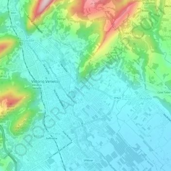
Name: Costa topographic map, elevation, terrain.

Location: Costa, Vittorio Veneto, Treviso, Veneto, 31029, Italia (45.96869 12.29024 46.00869 12.33024)

Average elevation: 192 m

Minimum elevation: 101 m

Maximum elevation: 504 m

Gear up for your next adventure:

🧳Compression Sacks - Maximize space in your backpack by shrinking gear
💧Hydration Pack - Hands-free hydration system for long hikes
🧢Beanie Hat - Keep your head warm in cold weather
🌬️Windproof Camp Stove - Efficient cooking even on exposed mountain peaks
🥾Light Hiking Boots - Lightweight and comfortable boots for day hikes

As an Amazon Associate, this site earns from qualifying purchases at no extra cost to you.