
Schweckhausen topographic map
Interactive map
Click on the map to display elevation.
About this map
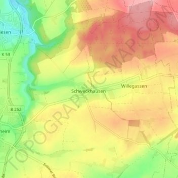
Name: Schweckhausen topographic map, elevation, terrain.
Average elevation: 238 m
Minimum elevation: 164 m
Maximum elevation: 304 m
Other topographic maps
Click on a map to view its topography, its elevation and its terrain.
Peckelsheim
Deutschland > Nordrhein-Westfalen > Willebadessen
Peckelsheim, Willebadessen, Kreis Höxter, Regierungsbezirk Detmold, Nordrhein-Westfalen, Deutschland
Average elevation: 229 m
Altenheerse
Deutschland > Nordrhein-Westfalen > Willebadessen > Altenheerse
Altenheerse, Willebadessen, Kreis Höxter, Nordrhein-Westfalen, Deutschland
Average elevation: 263 m