Geolocate

Sondor topographic map

Click on the map to display elevation.

About this map

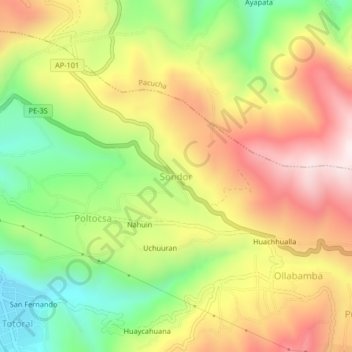
Name: Sondor topographic map, elevation, terrain.

Location: Sondor, San Jerónimo, Andahuaylas, Apurímac, 03730, Perú (-13.66520 -73.35118 -13.62520 -73.31118)

Average elevation: 3,329 m

Minimum elevation: 3,003 m

Maximum elevation: 3,664 m

Gear up for your next adventure:

🥾Durable Hiking Shoes - Long-lasting shoes for frequent hiking
🏕️Camping Hammock - Integrated protection for sleeping between trees
💡Portable Camping Lamp - Rechargeable lamp for campsite lighting
🪑Ultralight Camping Stool - Compact seating for rest stops during long hikes
🥾Hiking Gaiters - Protect legs and shoes from mud, snow, and debris

As an Amazon Associate, this site earns from qualifying purchases at no extra cost to you.