
Saint-Trond topographic map
Interactive map
Click on the map to display elevation.
About this map
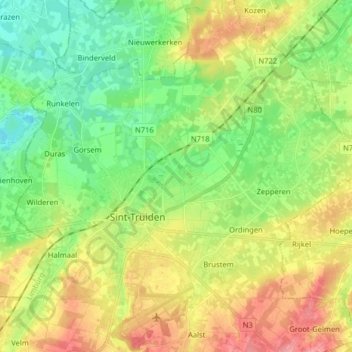
Name: Saint-Trond topographic map, elevation, terrain.
Location: Saint-Trond, Hasselt, Limbourg, Flandre, Belgique (50.77642 5.14971 50.87732 5.24488)
Average elevation: 54 m
Minimum elevation: 20 m
Maximum elevation: 101 m
Other topographic maps
Click on a map to view its topography, its elevation and its terrain.