Geolocate

Quetena topographic map

Click on the map to display elevation.

About this map

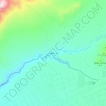
Name: Quetena topographic map, elevation, terrain.

Location: Quetena, Calama, Provincia de El Loa, Antofagasta, Chile (-22.46540 -68.99319 -22.42540 -68.95319)

Average elevation: 2,254 m

Minimum elevation: 2,143 m

Maximum elevation: 2,621 m

Gear up for your next adventure:

🚲Handlebar Phone Mount - View topographic-map.com live while cycling
🥾Hiking Leggings - Comfortable leggings for outdoor activities
🧶550 Survival Paracord - Versatile utility cord for emergency repairs and rigging
🧥Thermal Fleece Jacket - Versatile insulation for changing mountain temperatures
🧴Sunscreen SPF - Broad-spectrum sunscreen for outdoor activities

As an Amazon Associate, this site earns from qualifying purchases at no extra cost to you.