
Bründl topographic map
Interactive map
Click on the map to display elevation.
About this map
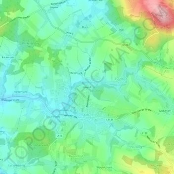
Name: Bründl topographic map, elevation, terrain.
Location: Bründl, Riedlhof, Raab, Bezirk Schärding, 4760, Österreich (48.33880 13.62626 48.37880 13.66626)
Average elevation: 406 m
Minimum elevation: 356 m
Maximum elevation: 534 m