
Make a donation
Gear up for your next adventure:
As an Amazon Associate, this site earns from qualifying purchases at no extra cost to you.
Orbeti topographic map
Click on the map to display elevation.
Make a donation
Gear up for your next adventure:
As an Amazon Associate, this site earns from qualifying purchases at no extra cost to you.
About this map
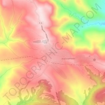
Name: Orbeti topographic map, elevation, terrain.
Location: Orbeti, Tetritskaro Municipality, Lower Kartli, Georgia (41.64665 44.50599 41.68665 44.54599)
Average elevation: 1,218 m
Minimum elevation: 916 m
Maximum elevation: 1,369 m
Make a donation
Gear up for your next adventure:
As an Amazon Associate, this site earns from qualifying purchases at no extra cost to you.
Other topographic maps
Click on a map to view its topography, its elevation and its terrain.
Tetritskaro
Georgia > Lower Kartli > Tetritskaro Municipality > Tetritskaro
Average elevation: 1,162 m
Make a donation
Gear up for your next adventure:
As an Amazon Associate, this site earns from qualifying purchases at no extra cost to you.