

Pokhara topographic map
Click on the map to display elevation.
Pokhara
Pokhara is in the northwestern corner of the Pokhara Valley, which is a widening of the Seti Gandaki valley that lies in the region (Pahad) of the Himalayas. In this region the mountains rise very quickly, and within 30 kilometres (19 miles), the elevation rises from 1,000 to 7,500 metres (3,300 to 24,600 feet). As a result of this sharp rise in altitude the area of Pokhara has one of the highest precipitation rates in the country (3,350 mm/year or 131 inches/year in the valley to 5600 mm/year or 222 inches/year in Lumle). Even within the city there is a noticeable difference in rainfall between the south and the north: The northern part at the foothills of the mountains experiences a proportionally higher amount of precipitation.
About this map
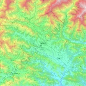
Name: Pokhara topographic map, elevation, terrain.
Location: Pokhara, Kaski, Gandaki Pradesh, 3, Nepal (28.04954 83.83140 28.36954 84.15140)
Average elevation: 1,222 m
Minimum elevation: 483 m
Maximum elevation: 3,223 m