Geolocate

Vincent topographic map

Click on the map to display elevation.

About this map

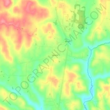
Name: Vincent topographic map, elevation, terrain.

Location: Vincent, Washington County, Ohio, 45784, United States (39.35535 -81.68957 39.39535 -81.64957)

Average elevation: 235 m

Minimum elevation: 191 m

Maximum elevation: 279 m

Gear up for your next adventure:

🥾Lightweight Hiking Boots - Boots for comfort and mobility on long hikes
🧊Portable Cooler - Keep food and drinks cold during outdoor adventures
🧴Waterproofing Spray - Restore the DWR coating on jackets and tents
🛁Quick-Dry Microfiber Towel - Space-saving towel that dries rapidly on the move
🧴Bear Spray Holster - Quick-access carry for essential Canadian wilderness safety

As an Amazon Associate, this site earns from qualifying purchases at no extra cost to you.