Geolocate

Somport topographic map

Click on the map to display elevation.

Somport

Somport (en francés Col du Somport) es un puerto de montaña de los Pirineos, con una altitud de 1640 metros. En los alrededores se encuentran las estaciones de esquí de Candanchú, Astún y Le Somport.

Wikipedia (CC-BY-SA 3.0)

About this map

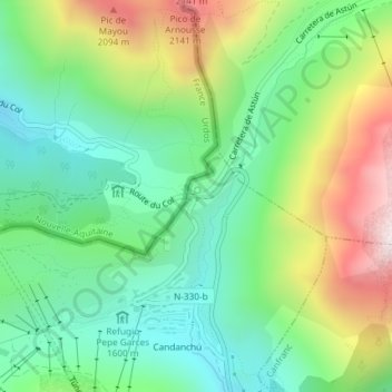
Name: Somport topographic map, elevation, terrain.

Location: Somport, Candanchú, Aísa, La Jacetania, Huesca, Aragón, 22889, España (42.79567 -0.52490 42.79577 -0.52480)

Average elevation: 1,727 m

Minimum elevation: 1,449 m

Maximum elevation: 2,243 m

Gear up for your next adventure:

🚲Heavy Duty Bike Lock - Secure your bike at the trailhead or during stops
🥾Hiking Shorts - Breathable shorts suitable for summer hikes
🛶Kayak Accessories - Essential gear for safe and fun kayaking adventures
👟Sport Hiking Sandals - Breathable footwear for water crossings and camp rest
🧥Softshell Hiking Jacket - The perfect balance of wind protection and breathability

As an Amazon Associate, this site earns from qualifying purchases at no extra cost to you.