Geolocate

Bocabamba topographic map

Click on the map to display elevation.

About this map

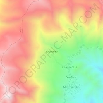
Name: Bocabamba topographic map, elevation, terrain.

Location: Bocabamba, Ccapaccasa, Haquira, Cotabambas, Apurímac, Perú (-14.15673 -72.14638 -14.11673 -72.10638)

Average elevation: 4,125 m

Minimum elevation: 3,558 m

Maximum elevation: 4,613 m

Gear up for your next adventure:

🛶Kayak Dry Bag - Waterproof storage for kayaking adventures
🔋Lithium AA Batteries - Long-lasting power that performs in extreme cold
🧳Compression Sacks - Maximize space in your backpack by shrinking gear
👟Trail Running Shoes - Agile footwear for fast-paced topographic exploration
📷Outdoor Action Camera - Capture high-elevation views and rugged adventures

As an Amazon Associate, this site earns from qualifying purchases at no extra cost to you.