
Thank you for supporting this site ❤️
Make a donation
Make a donation
Gear up for your next adventure:
As an Amazon Associate, this site earns from qualifying purchases at no extra cost to you.
Talhadas topographic map
Click on the map to display elevation.
Thank you for supporting this site ❤️
Make a donation
Make a donation
Gear up for your next adventure:
As an Amazon Associate, this site earns from qualifying purchases at no extra cost to you.
About this map
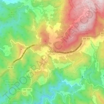
Name: Talhadas topographic map, elevation, terrain.
Location: Talhadas, Sever do Vouga, Aveiro, Centro, 3740-412, Portugal (40.63676 -8.37454 40.69454 -8.28883)
Average elevation: 362 m
Minimum elevation: 73 m
Maximum elevation: 759 m
Thank you for supporting this site ❤️
Make a donation
Make a donation
Gear up for your next adventure:
As an Amazon Associate, this site earns from qualifying purchases at no extra cost to you.