Geolocate

Songyang County topographic map

Click on the map to display elevation.

About this map

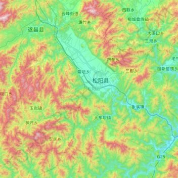
Name: Songyang County topographic map, elevation, terrain.

Location: Songyang County, Lishui, Zhejiang, China (28.24161 119.16497 28.60810 119.73530)

Average elevation: 531 m

Minimum elevation: 67 m

Maximum elevation: 1,606 m

Other topographic maps

Click on a map to view its topography, its elevation and its terrain.

Baoxi

China > Zhejiang > Lishui

Average elevation: 765 m

Gear up for your next adventure:

🧢Hiking Hat - Sun-protective and breathable hats for long treks
🧢Outdoor Visor - Breathable visor for sunny hikes
🌡️Emergency Mylar Blankets - Compact thermal protection for unexpected nights outdoors
🧊Portable Cooler - Keep food and drinks cold during outdoor adventures
🥾Hiking Leggings - Comfortable leggings for outdoor activities

As an Amazon Associate, this site earns from qualifying purchases at no extra cost to you.