Geolocate

Cadyville topographic map

Click on the map to display elevation.

About this map
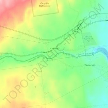
Name: Cadyville topographic map, elevation, terrain.

Location: Cadyville, Town of Plattsburgh, Clinton County, New York, United States (44.68769 -73.66782 44.70470 -73.61651)

Average elevation: 236 m

Minimum elevation: 174 m

Maximum elevation: 319 m

Other topographic maps

Click on a map to view its topography, its elevation and its terrain.
Clintonville

United States > New York > Clinton County

Average elevation: 195 m

Ausable Chasm

United States > New York > Clinton County

Average elevation: 117 m

Gear up for your next adventure:

🛏️Camping Sleeping Mat - Comfortable mats for sleeping outdoors
🔪Outdoor Multitool - Versatile tool for repairs and food prep in the wild
🔋Lithium AA Batteries - Long-lasting power that performs in extreme cold
🧢Sun Protection Cap - Breathable cap to protect from sun exposure
💧Filtered Water Bottle - Safe drinking water on the go

As an Amazon Associate, this site earns from qualifying purchases at no extra cost to you.