Geolocate

Talon Dos topographic map

Click on the map to display elevation.

About this map
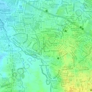
Name: Talon Dos topographic map, elevation, terrain.

Location: Talon Dos, 2nd District, Las Piñas, Southern Manila District, Metro Manila, Philippines (14.42428 120.97211 14.44848 121.00059)

Average elevation: 19 m

Minimum elevation: 8 m

Maximum elevation: 34 m

Other topographic maps

Click on a map to view its topography, its elevation and its terrain.

Balihatar Creek

Philippines > Las Piñas

Average elevation: 7 m

Gear up for your next adventure:

🥫Freeze-Dried Meals - Lightweight, high-calorie nutrition for multi-day treks
🥾Waterproof Hiking Boots - Boots keeping your feet dry in wet conditions
🧴Bear Spray Holster - Quick-access carry for essential Canadian wilderness safety
🧴Outdoor Sunscreen - High SPF protection for high-altitude UV exposure
🔦LED Headlamp - Hands-free lighting for early morning starts or late finishes

As an Amazon Associate, this site earns from qualifying purchases at no extra cost to you.