Geolocate

Mosquito topographic map

Click on the map to display elevation.

About this map

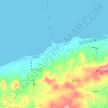
Name: Mosquito topographic map, elevation, terrain.

Location: Mosquito, Vieques, Puerto Rico, United States (18.10626 -65.54679 18.15133 -65.50412)

Average elevation: 39 m

Minimum elevation: -2 m

Maximum elevation: 161 m

Gear up for your next adventure:

🧼Travel Hand Sanitizer - Keep hands clean when water is scarce
🥾Waterproof Trail Shoes - Shoes designed to handle wet terrain
Bushcraft Tarp - Versatile emergency shelter or gear protection
🥾Hiking Shorts - Breathable shorts suitable for summer hikes
🧥Waterproof Pants - Keep dry during rainy hiking conditions

As an Amazon Associate, this site earns from qualifying purchases at no extra cost to you.