
Thank you for supporting this site ❤️
Make a donation
Make a donation
Gear up for your next adventure:
As an Amazon Associate, this site earns from qualifying purchases at no extra cost to you.
Al `Abayah topographic map
Click on the map to display elevation.
Thank you for supporting this site ❤️
Make a donation
Make a donation
Gear up for your next adventure:
As an Amazon Associate, this site earns from qualifying purchases at no extra cost to you.
About this map
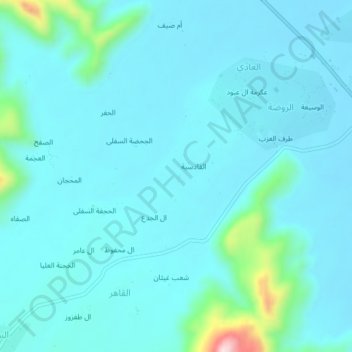
Name: Al `Abayah topographic map, elevation, terrain.
Location: Al `Abayah, Al Hajar, Harib district, Marib Governorate, Yemen (14.91294 45.43769 14.95294 45.47769)
Average elevation: 1,209 m
Minimum elevation: 1,167 m
Maximum elevation: 1,532 m
Thank you for supporting this site ❤️
Make a donation
Make a donation
Gear up for your next adventure:
As an Amazon Associate, this site earns from qualifying purchases at no extra cost to you.