
Delavan topographic map
Click on the map to display elevation.
About this map
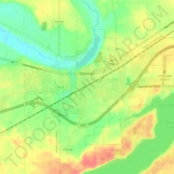
Name: Delavan topographic map, elevation, terrain.
Location: Delavan, Walworth County, Wisconsin, 53115, United States (42.60406 -88.67854 42.65103 -88.58223)
Average elevation: 287 m
Minimum elevation: 263 m
Maximum elevation: 314 m
Other topographic maps
Click on a map to view its topography, its elevation and its terrain.
Pell Lake
United States > Wisconsin > Walworth County > Village of Bloomfield
Average elevation: 263 m