
Munds Park topographic map
Click on the map to display elevation.
About this map
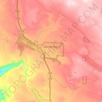
Name: Munds Park topographic map, elevation, terrain.
Location: Munds Park, Coconino County, Arizona, 86017, United States (34.89737 -111.70795 34.98411 -111.56710)
Average elevation: 2,049 m
Minimum elevation: 1,492 m
Maximum elevation: 2,320 m
Other topographic maps
Click on a map to view its topography, its elevation and its terrain.