Geolocate

Montaner topographic map

Click on the map to display elevation.

About this map

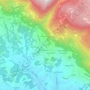
Name: Montaner topographic map, elevation, terrain.

Location: Montaner, Sarmede, Province of Treviso, Veneto, 31026, Italy (45.97900 12.35882 46.01900 12.39882)

Average elevation: 410 m

Minimum elevation: 100 m

Maximum elevation: 1,051 m

Gear up for your next adventure:

Camping Coffee Maker - Brew fresh coffee anywhere on the topographic map
🛰️Satellite Messenger - Emergency communication for areas with no cell service
🔥Camping Stove - Portable stoves to cook outdoors with ease
🧰Multitool Knife - Compact and versatile tool for outdoor use
🎒Hiking Backpack - Lightweight and ergonomic backpacks for day hikes or multi-day treks

As an Amazon Associate, this site earns from qualifying purchases at no extra cost to you.