Geolocate

Marín topographic map

Click on the map to display elevation.

About this map

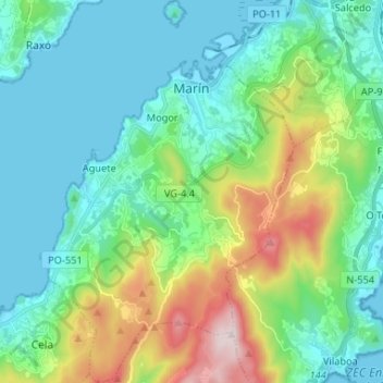
Name: Marín topographic map, elevation, terrain.

Location: Marín, O Morrazo, Pontevedra, Galicia, Spain (42.31770 -8.75479 42.41450 -8.66771)

Average elevation: 153 m

Minimum elevation: -2 m

Maximum elevation: 626 m

Other topographic maps

Click on a map to view its topography, its elevation and its terrain.

Cangas

Spain > Galicia > O Morrazo > Cangas

Average elevation: 54 m

Gear up for your next adventure:

🧦Thermal Socks - Warm socks for winter hiking or camping
🚲Handlebar Phone Mount - View topographic-map.com live while cycling
🔭Compact Monocular - One-handed bird watching and trail spotting
🧴Waterproofing Spray - Restore the DWR coating on jackets and tents
🔋Solar Power Bank - Keep your GPS and devices charged during long outdoor trips

As an Amazon Associate, this site earns from qualifying purchases at no extra cost to you.