
Make a donation
Gear up for your next adventure:
As an Amazon Associate, this site earns from qualifying purchases at no extra cost to you.
Iseringhausen topographic map
Click on the map to display elevation.
Make a donation
Gear up for your next adventure:
As an Amazon Associate, this site earns from qualifying purchases at no extra cost to you.
Iseringhausen
Iseringhausen liegt auf einer Höhe von um die 377 m im südwestlichen Sauerland etwa drei Kilometer südlich des Drolshagener Zentrums und sieben Kilometer südwestlich von Olpe. Iseringhausen liegt im Brachtpetal umgeben von den Hügeln des südwestlichen Sauerlandes unweit des Biggesee.
Make a donation
Gear up for your next adventure:
As an Amazon Associate, this site earns from qualifying purchases at no extra cost to you.
About this map
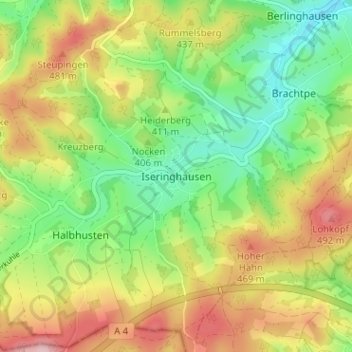
Name: Iseringhausen topographic map, elevation, terrain.
Average elevation: 408 m
Minimum elevation: 320 m
Maximum elevation: 522 m
Make a donation
Gear up for your next adventure:
As an Amazon Associate, this site earns from qualifying purchases at no extra cost to you.