Geolocate

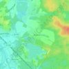
Tröbitz topographic map

Click on the map to display elevation.

About this map

Name: Tröbitz topographic map, elevation, terrain.

Location: Tröbitz, Elsterland, Elbe-Elster, Brandenburg, Duitsland (51.57574 13.40882 51.61701 13.46419)

Average elevation: 111 m

Minimum elevation: 90 m

Maximum elevation: 144 m

Other topographic maps

Click on a map to view its topography, its elevation and its terrain.
Dobra

Duitsland > Brandenburg > Elbe-Elster > Bad Liebenwerda

Average elevation: 97 m

Gear up for your next adventure:

🥾Trail Running Shoes - Lightweight and durable shoes for trail running
🥾Hiking Gaiters - Protect legs and shoes from mud, snow, and debris
🎒Fully Waterproof Backpack - Total protection for photography gear and electronics
🥾Hiking Boots - Sturdy boots providing ankle support and traction on rugged trails
🧥Softshell Jacket - Windproof and breathable jacket for hiking

As an Amazon Associate, this site earns from qualifying purchases at no extra cost to you.