
Thank you for supporting this site ❤️
Make a donation
Make a donation
Gear up for your next adventure:
As an Amazon Associate, this site earns from qualifying purchases at no extra cost to you.
Heliopolis topographic map
Click on the map to display elevation.
Thank you for supporting this site ❤️
Make a donation
Make a donation
Gear up for your next adventure:
As an Amazon Associate, this site earns from qualifying purchases at no extra cost to you.
About this map
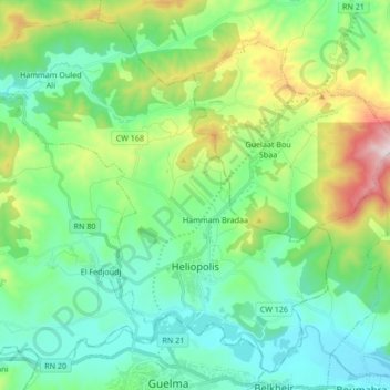
Name: Heliopolis topographic map, elevation, terrain.
Location: Heliopolis, Heliopolis District, Guelma, 24008, Algeria (36.46900 7.33312 36.59224 7.50172)
Average elevation: 348 m
Minimum elevation: 159 m
Maximum elevation: 850 m
Thank you for supporting this site ❤️
Make a donation
Make a donation
Gear up for your next adventure:
As an Amazon Associate, this site earns from qualifying purchases at no extra cost to you.